Sport stats, first half of 2013
Some numbers about my sport activities in the first half of 2013.
di Lorenzo Clementi |
Commenti |
Immagini |
Tempo di lettura: 1 - 2 min
After attending the Semi Trail Ticino three weeks ago, I'm taking a break to recover after 6 months of intense training -- intense for my standards, of course.
As I did at the end of 2012, I'm publishing some numbers about my training activites.
Please read carefully the introduction to my 2012 post: the same remarks apply here. Long story short: this is just for fun, don't take it as a serious training plan. Many of these numbers are based on rough estimates and, finally, feel free to tell me what you think about it.

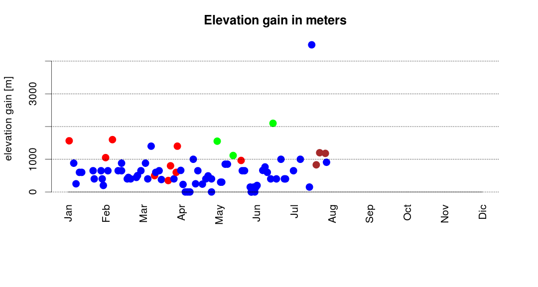
Figure 1 - Elevation gain: each bullet corresponds to an activity. Blue is running, trekking, walking, and so on; red is for ski-mountaineering; green is for mixed ativites (bycicle + running) and brown is for cycling.
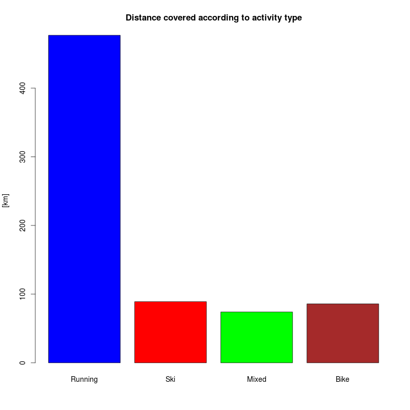
This year I covered approximately 467km running for a cumulative elevation gain of 35415m, up to now. The months where I did more elevation gain by running are February, March (approx. 7000m) and June (7400m): these months have been fundamental in preparing for the Semi Trail Ticino (see Figure 1, the blue dot outlier corresponds to the Semi Trail).
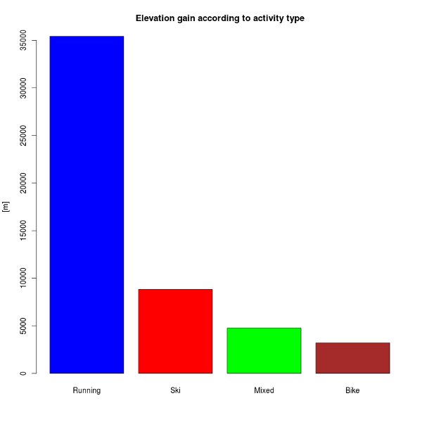
Figure 2 - Elevation gain according to activity type.
Figure 2 shows the elevation gain stratified by activity type: most of the elevation gain was covered by running. My log about the ski-mountaineering is not 100% complete, so I probably miss some meters there. These numbers do not account for the bicycle commuting (approximately 400km till now).
This autumn, if possible, I would like to dedicate more time to the mountain bike.
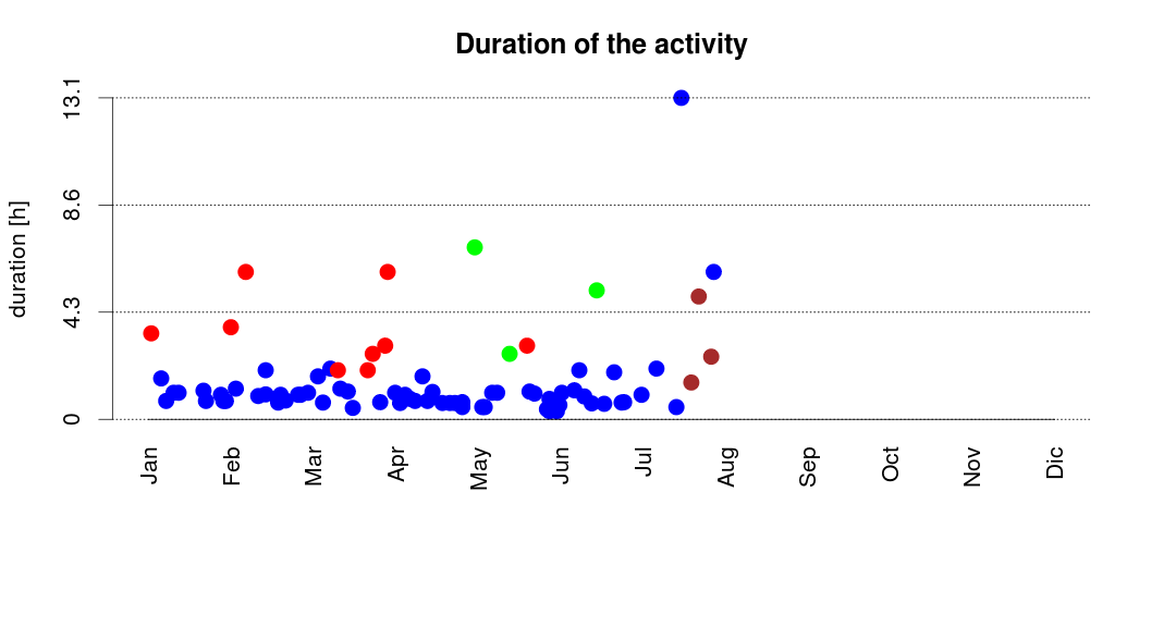
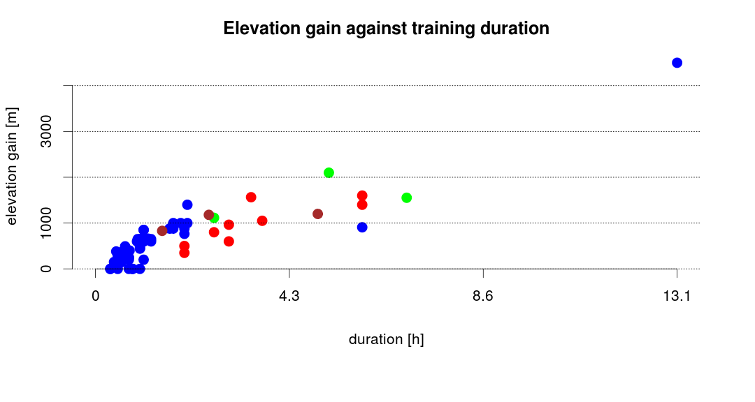
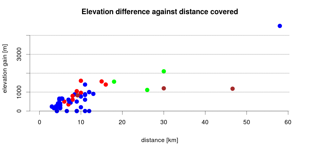
Below you can find a larger version of these images, together with some other plots illustrating the data I collected in the first half of 2013.
Attached to this post you can find the source code and the input data used to compute these numbers (the code is written in R).

Questo post ha un allegato: scaricalo qui.